ContextCapture
Create 3D models from simple photographs and/or point clouds

Reality Modelling Software
With ContextCapture, you can quickly produce even the most challenging 3D models of existing conditions for infrastructure projects of all types, derived from simple photographs and/or point clouds. Without the need for expensive, specialised equipment, you can quickly create and use these highly detailed, 3D reality meshes to provide precise real-world context for design, construction, and operations decisions for use throughout the lifecycle of a project.
Hybrid processing in ContextCapture enables the creation of engineering-ready reality meshes that incorporate the best of both worlds – the versatility and convenience of high-resolution photography supplemented, where needed, by additional accuracy of point clouds from laser scanning.
Develop precise reality meshes affordably with less investment of time and resources in specialised acquisition devices and associated training. You can easily produce 3D models using up to 300 gigapixels of photos taken with an ordinary camera and/or 500 million points from a laser scanner, resulting in fine details, sharp edges, and geometric accuracy.
Extend your capabilities to extract value from reality modelling data with ContextCapture Editor, a 3D CAD module for editing and analysing reality data, included with ContextCapture. ContextCapture Editor enables fast and easy manipulation of meshes of any scale as well as the generation of cross sections, extraction of ground and breaklines, and production of orthophotos, 3D PDFs, and iModels. You can integrate your meshes with GIS and engineering data to enable the intuitive search, navigation, visualisation, and animation of that information within the visual context of the mesh to quickly and efficiently support the design process.
Consume imagery from many cameras and sensor types
Utilise a wide variety of cameras, from smartphones to highly-specialised airborne or terrestrial multidirectional acquisition systems. Take advantage of any available image format and metadata to create 3D models.

Consume laserscan data
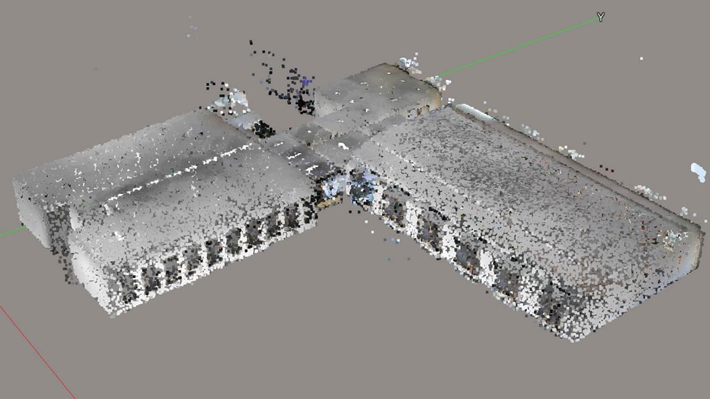
Import static or mobile laserscan data. Combine it with photos to get very high accuracy reality meshes.
Create animations, videos and fly-throughs
Produce high-resolution orthographic and perspective images by rendering snapshots of any size. Set image size and scales using output rulers, scale, and positioning for accurate reuse. Take advantage of the intuitive time-based fly-through and object animation system for quick and easy movie production.
Create high-fidelity images
Use high-fidelity imaging tools to support precision mapping and engineering. Combine imagery in virtually any format and projection.
Create scaleable terrain models
Use and display very large terrain models to increase return on investment on large datasets. Display scalable terrain models in a variety of modes, such as smooth shading with shadows, aspect angle, elevation, slope, contours, and more. Synchronise terrain models with source data such as DGN files, point-cloud data, and more.
Generate 2D and 3D GIS models
Produce accurate georeferenced 3D models using a full range of geospatial data types including true orthophotos, point clouds, raster digital elevation models and Esri I3S format. Includes an SRS database interface to ensure interoperability with your GIS solution of choice.
Generate 3D CAD models
Produce 3D models using a range of traditional CAD formats such as STL, OBJ or FBX, point cloud formats, as well as innovative multiresolution meshes like the Bentley open 3SM or 3MX to ensure your models are accessible in your modelling environment.
Integrate data from many sources with reality meshes
Enrich reality meshes with additional data like geospatial information, by attaching it to specific parts of the mesh, providing the ability to subsequently search and visualise regions of a mesh based on the associated data.
Measure and analyse model data
Save time getting accurate answers by performing precise measurements of distances, volumes, and surface areas directly within the 3D viewing interface.
Integrate data from many sources with reality meshes
Enrich reality meshes with additional data like geospatial information, by attaching it to specific parts of the mesh, providing the ability to subsequently search and visualise regions of a mesh based on the associated data.
Model geometry from reality modelling data
Extract break lines, paint lines, surfaces, planes, cylinder, and cylinder center lines from reality meshes and point clouds. Efficiently clip and section point cloud and reality meshes to streamline vector extraction.
Perform automatic aerotriangulation and 3D reconstruction
Fully calibrate all images by automatically identifying the relative position and orientation of each photo. Employ automatic 3D reconstruction, texture mapping, and retexturing of ties and reconstruction constraints to ensure highly accurate models.
Publish and view Web-ready models
Produce models of any size that are optimised for Web publishing and that can be viewed using a free plugin Web viewer. This enables instant sharing and visualisation of 3D models on the Web.
Visualise, manipulate and edit reality modelling data
Visualise and edit point clouds with billions of points, changing their classification, colour and removing or editing points. Manipulate reality meshes and scalable terrain models with hundreds of millions of triangles. Import, retouch, and export meshes in many formats.
